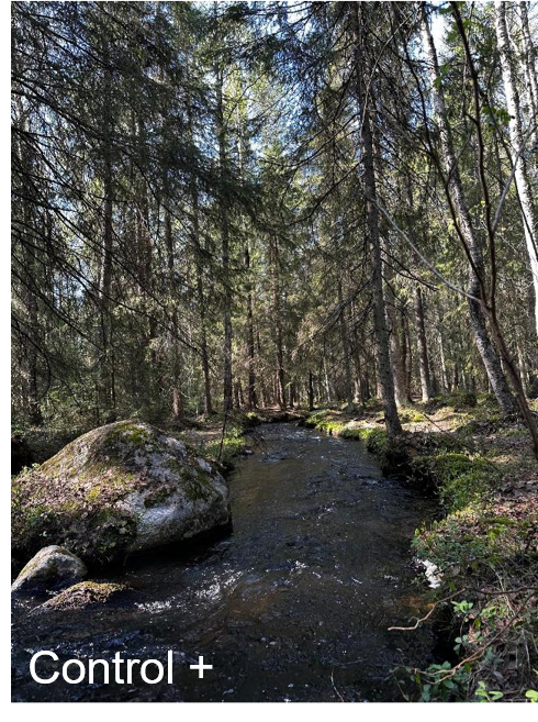
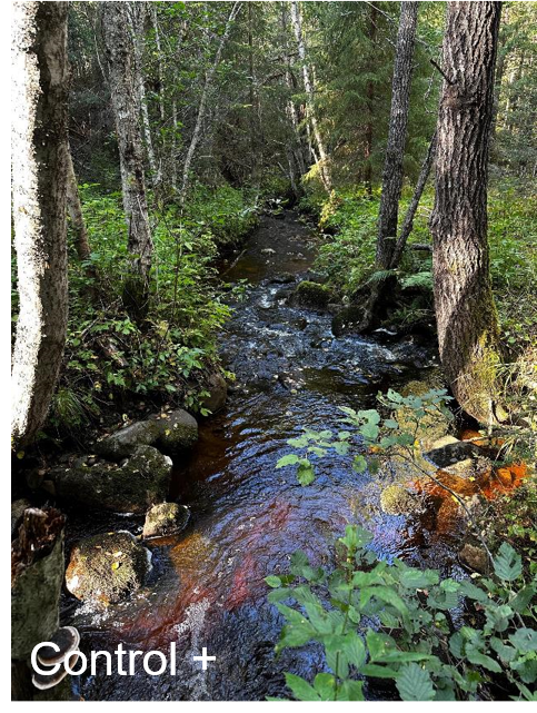
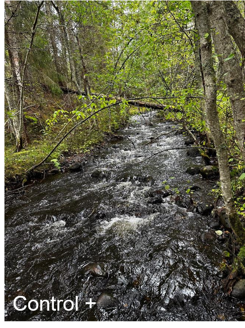
Kolbäcken (positive control). The stream is downstream of a lake (Nydalasjön) flowing through a forested meandering channel bordered by preserved riparian vegetation. Riparian trees are primarily spruce with a shrub understory. Local landscape is dominated by forest cover, but there is some suburban development (housing) in the catchment. The study reach (100 m) is located in a riffle section of the stream ca. 500 m from the lake outlet. Rocky stream bottom dominates (i.e., pebble and gravel), but there is some sandy areas and organic soils, as well as macrophytes along the reach.
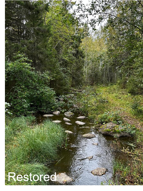
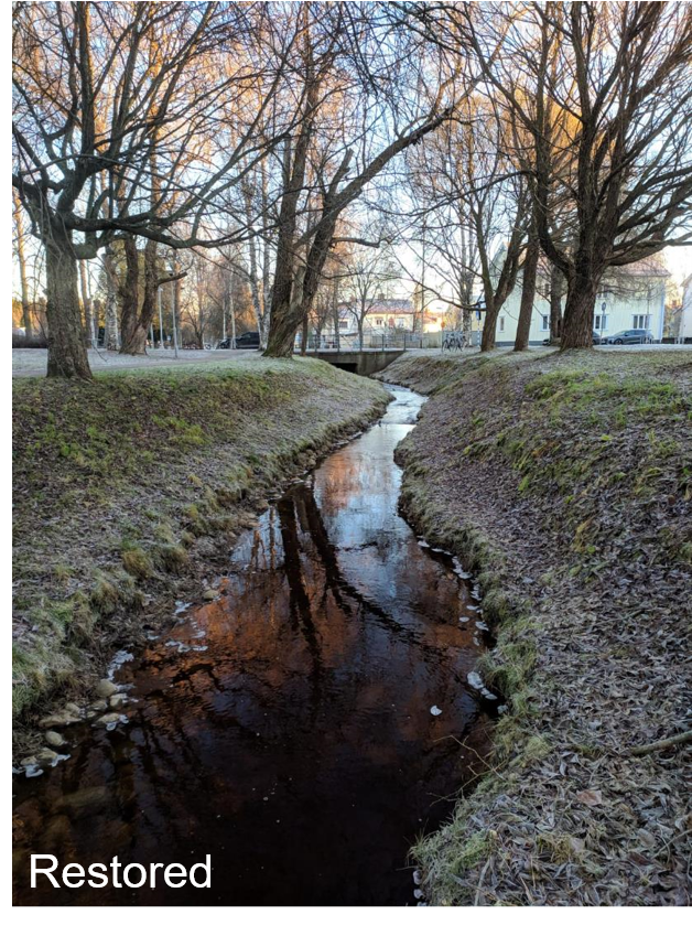
Djupsundbäcken (restored site). The stream is located downstream of a lake (Väster-Långslädan). The study reach (100 m) was restored by adding boulders to the channel to increase complexity. Channel meanders were also created. The run-dominated study reach (there are a few riffles) flows in a forested meandering channel with intact riparian vegetation composed primarily by birch, spruce, and shrubs. The catchment has extensive forest cover, but also sub-urban development (housing). Rocky stream bottom (i.e., pebble and gravel) dominates, but there is some sandy areas and organic soils along the reach, as well as the presence of macrophytes in some stretches.
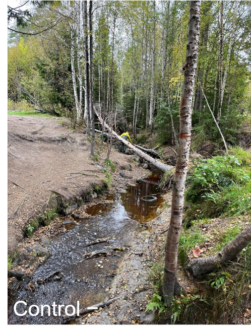
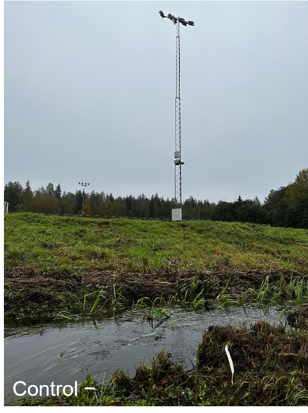
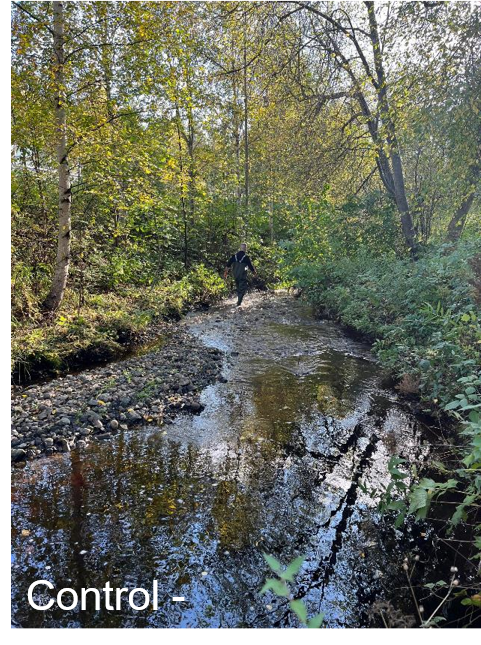
Djulpbäcken (negative control). The stream flows in a meandering channel with discontinuous cover by riparian vegetation (primarily birch with understory shrubs). Banks are highly eroded in many places. The catchment is mostly forested, but with extensive land clearing locally for recreational activities (frisbee golf). There is some refuse inside the channel. The study reach (100 m) is located in a riffle-pool-run section of the stream. Sandy stream bottom dominates, but there are some clay areas, as well as pebbles, gravel and in-stream woody along the reach.
Djupsundbäcken (restored site). The stream is located downstream of a lake (Väster-Långslädan). The study reach (100 m) was restored by adding boulders to the channel to increase complexity. Channel meanders were also created. The run-dominated study reach (there are a few riffles) flows in a forested meandering channel with intact riparian vegetation composed primarily by birch, spruce, and shrubs. The catchment has extensive forest cover, but also sub-urban development (housing). Rocky stream bottom (i.e., pebble and gravel) dominates, but there is some sandy areas and organic soils along the reach, as well as the presence of macrophytes in some stretches.
Djulpbäcken (negative control). The stream flows in a meandering channel with discontinuous cover by riparian vegetation (primarily birch with understory shrubs). Banks are highly eroded in many places. The catchment is mostly forested, but with extensive land clearing locally for recreational activities (frisbee golf). There is some refuse inside the channel. The study reach (100 m) is located in a riffle-pool-run section of the stream. Sandy stream bottom dominates, but there are some clay areas, as well as pebbles, gravel and in-stream woody along the reach.
|
|
|
Kullabäcken tributary (positive control). The stream flows through a forested meandering channel with well-preserved riparian vegetation composed by trees (spruce and birch) and understory shrubs. Landscape dominated by forest cover locally, but with suburban development higher in the catchment. The study reach (ca. 100 m) is located in a riffle-run section of the stream. Rocky stream bottom (boulders, pebble and gravel) dominates, but there is some sandy areas and organic soils, as well as instream woody along the reach.
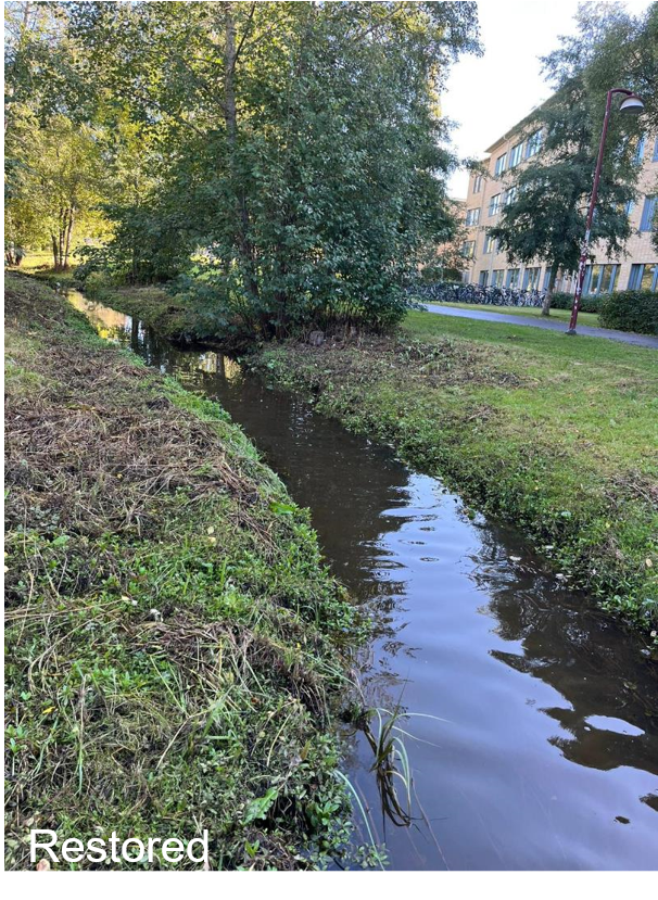
Sandbäcken (restored). The study stream was modified by Umeå University. Pebbles and cobbles dominate the stream bottom. The bank was also stabilized with some pebbles. The channel has a shaped and straighten morphology with riparian vegetation composed by weed and shrubs. The catchment is dominated by urban and sub-urban land use (i.e., inside the campus of Umeå Universitet). The reach (70 m) flows in a riffle dominated section of the stream. Rocky stream bottom (pebble and gravel) dominates, although there is some parts with the presence of instream woody debris.
Sandbäcken (negative control). The stream flows in a straighten channel without an overstory of riparian cover. Streamside vegetation is mainly composed of weeds and grass. The catchment is dominated by urban and sub-urban land use (i.e., inside the campus of Umeå Universitet). The study reach (100 m) is located in a run-dominated section of the stream. There is predominance of sand, clay and organic soils on the stream bottom, as well as a substantial presence of macrophytes along the reach.
|
|
|
Kullabäcken (positive control). The stream flows through a forested meandering channel with preserved riparian vegetation composed primarily by trees (Birches and Pines) and shrubs. The catchment is largely forested. The study reach (ca. 70 m) is located in a riffle-pool-run section of the stream. The substrate is diverse with predominance of pebbles, gravels and instream woody debris, but there were sandy areas on the bottom.
Sandbäcken (restored). The stream is located in a urban forested park (i.e., Haga Parken) and the study reach (100 m) was redesigned at the direction of Umeå commune. Pebbles and cobbles were added to the stream bottom. The bank was also stabilized with pebbles. The channel has a shaped and straighten morphology with riparian vegetation composed of weed and shrubs and a few trees. The catchment is dominated by urban land use. The reach flows in a riffle dominated section of the stream. Rocky stream bottom (pebble and gravel) alternated with sandy areas dominates, although there is some parts with the stream with woody debris.
Djupbäcken (negative control). The stream flows in a straighten channel with discontinuous cover by riparian vegetation (primarily birch) as well as weed and shrubs. The stream comes from a underground culvert. The catchment is dominated by urban and sub-urban land use. There was some refuse inside the channel. Sandy substrate dominates the upper part of the study reach (ca. 70 m), while pebbles and gravel predominate in the lower part. The upper part of the reach is pool-dominated whereas the lower part is mainly composed by riffles.
|
|
|
